Regionalized LCA
With openLCA you can perform regionalized impact assessment, accounting for specific conditions and characteristics of the location where the processes occur. With parameters, you can define regional characteristics affecting the imcts. Regional characteristics and information about geographic locations are contained in GeoJSON files that can be imported into openLCA
How to perform regionalized LCA-step by step
Check locations in openLCA
A regionalised LCA needs to understand locations. In openLCA 2, available locations in a database are shown in the navigation tab under Database → Background data → Locations.
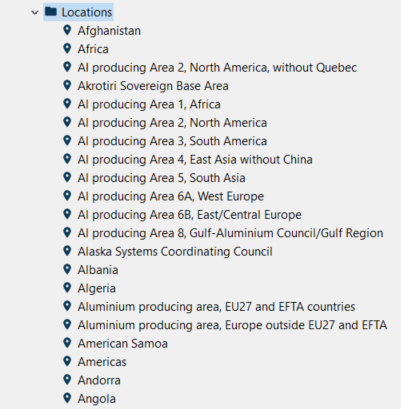
Available locations in a database
Opening one, you will see geographic data, including latitude, longitude and country code (e.g. ES for Spain), and the covered area defined by GeoJSON. It is also possible to modify the coordinates by using the text editor that can be opened by clicking on the pencil icon in the "Geographic data" section.
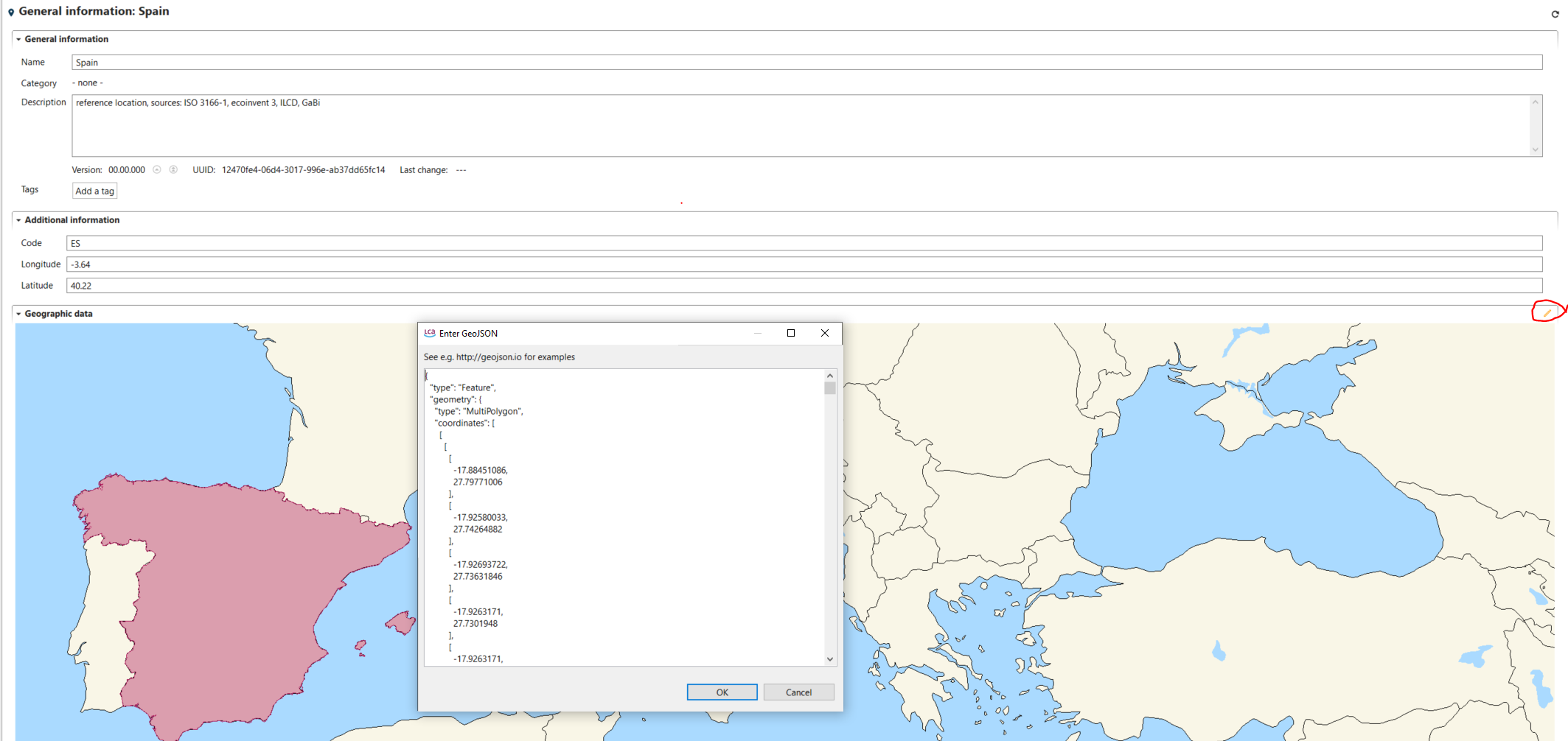
General geographic data - Example: Spain
Locations can be also imported in the active database, for instance from a GIS software, as GeoJSON files File → Import → other → geometries from GeoJSON.
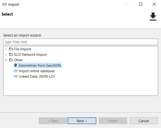
Import of locations into active database
Alternatively, locations can be also drawn by users in geojson.io as polygons, lines or points.
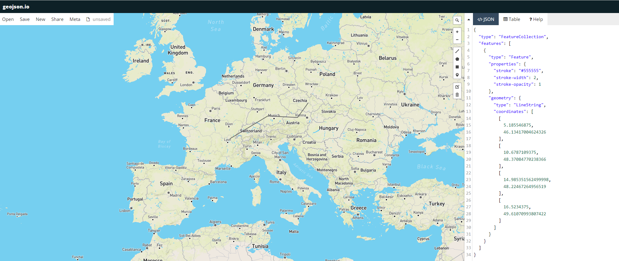
geojson.io example
The coordinates text can then be just pasted in the text editor in openLCA, after the creation of a new location (right click on location folder → new location → add name and country code → open the text editor in the geographic data ("pencil" icon) → paste coordinate text from geojson.io).
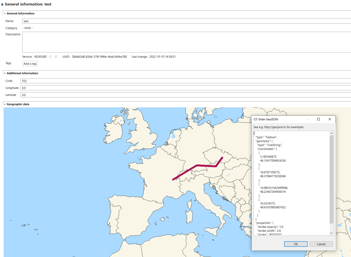
Use of coordinates text from geojson.io example in the openLCA text editor
Importing regional characteristics as GeoJSON file
Data for regional characteristics are contained in GeoJSON files, which can be imported in openLCA. To regionalize an impact category, first go to "impact categories" folder and open an existing category (or create a new one). Then go to the tab "regionalized calculation" for the opened category. Here you need to import regional characteristics (e.g. population density, watershed area, characterization factors…) by clicking on "open" and selecting GeoJSON files available in your laptop (e.g. previously exported from a GIS software). Parameters are extracted during the GeoJSON file import and are available under the section "GeoJSON Parameters".
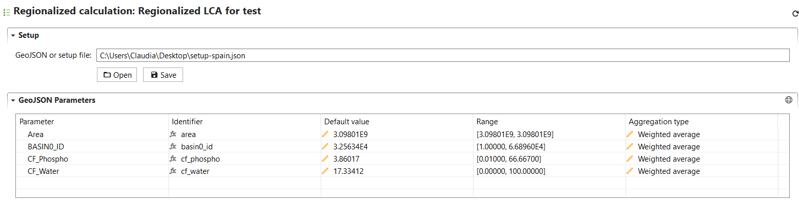
Regionalized calculation
Each imported parameter can be visualized in a map by selecting the parameter and clicking on the "world" icon in the GeoJSON Parameters section.
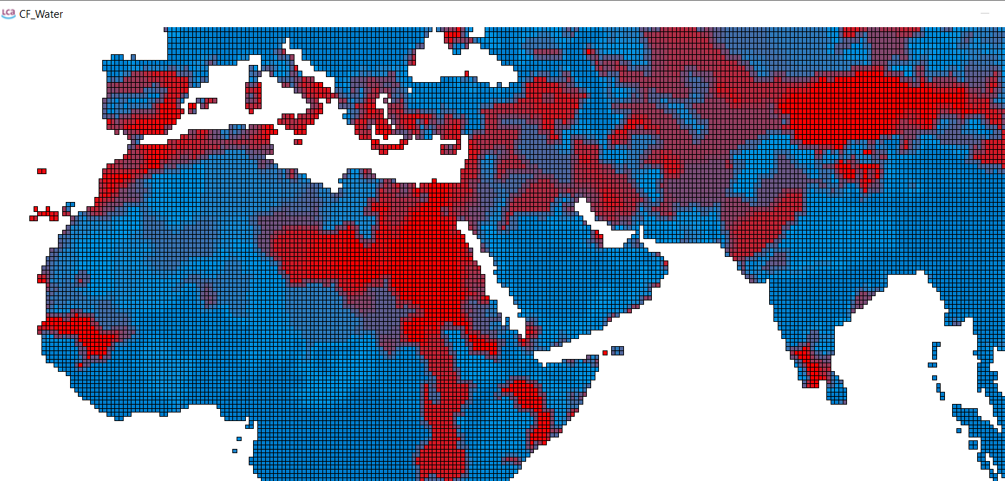
Visualization of parameters
Binding regional characteristics (GeoJSON files) to flows
Flows for which you want to calculate geo-spatial based CFs need to bound to the regional characteristics contained in GeoJSON files, so that the CFs can vary based on the selected location for exchanges and processes. In the "flow bindings" section under "regionalized calculation" in the open impact category, add the flows that you want to regionalize (use the "+" icon") and parametrize the "formula" field using the parameters extracted during the regional characteristics import and available under "GeoJSON parameters". In regionalized assessment, the parameter value derived from the GeoJSON file is used for the formula evaluation. Instead, if you apply non-regionalized LCIA or no location is available for exchanges and processes, the default CF value will be used in the calculations.
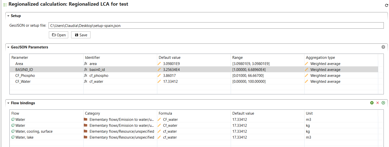
Example of flow binding and parameterization
Currently, openLCA cannot store the GeoJSON parameters and flow bindings, but you can save and export your setup by clicking on "save". You can import this configuration again at any time by clicking on "open" and selecting the exported setup.
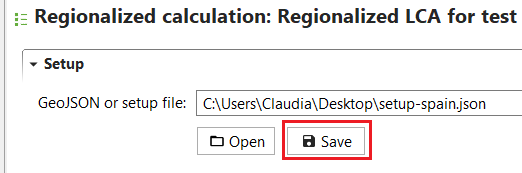
Saving geojson parameters and flow bindings
Calculate CFs for selected locations
The last step to set-up the regionalized LCIA method, is to link process locations and LCIA methods spatial units. Therefore, the intersection between GeoJSON file features and process geometries (stored in "Locations") is calculated by the software, thus resulting in dedicated CFs for locations selected by the user. By clicking on the "calculate" icon in the "flow bindings" section, the user defines the locations for which CFs are to be calculated for the flows added in the "flow bindings" section.
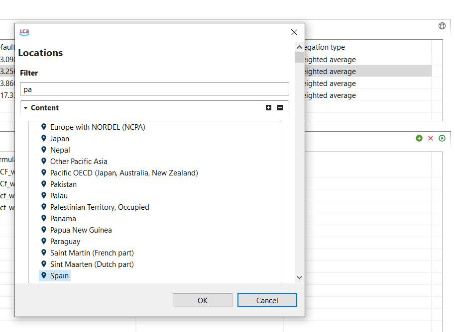 Defining the location for which the characterization factors are calculated
The resulting CFs for the selected locations and flows are available in the tab "characterization factors" for the open impact category. A flow for each selected location and the same flow without a specific location are created and assigned with a CF depending on the location, or with the default CF value for the case of the flow without a specific location.
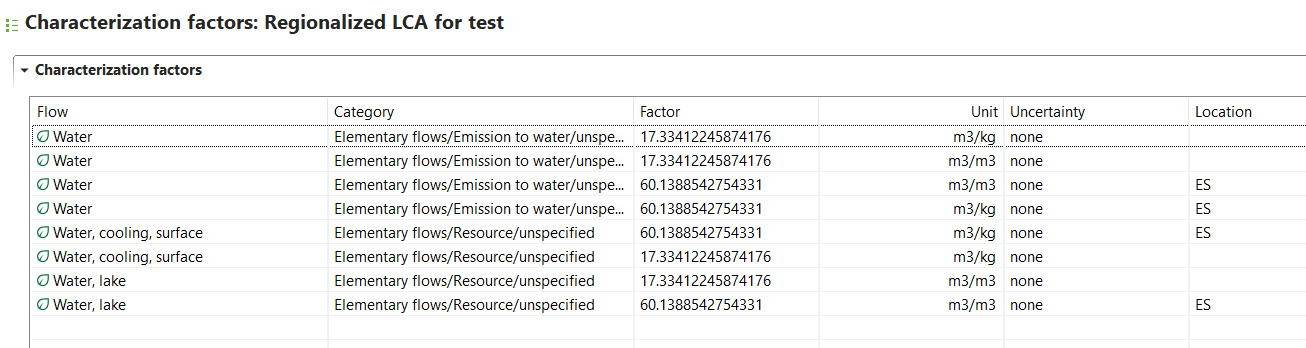
Example results of the tab "Characterization factors"
Add the regionalized impact category to an impact assessment method
When running LCIA, you need to select an impact assessment method. Therefore, the regionalized impact category/ies need to be added to the method that will be used to calculate the product system impact. To create a new regionalized method, right-click on the folder "impact assessment methods" and select "new LCIA method". Then you can add the previously created impact category in the section "impact categories" in the first tab "general information".
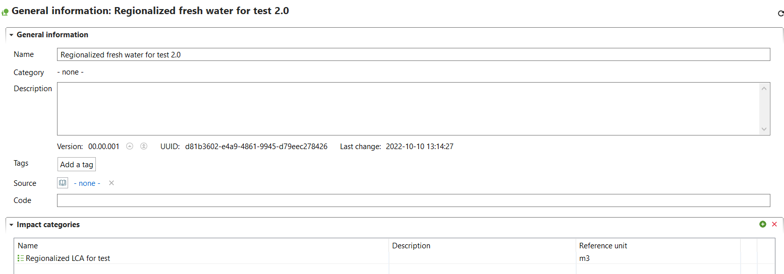
Adding an impact category to the tab "General information"
Assign locations to processes and exchanges
To perform regionalized LCIA, make sure to assign a location to your processes and/or exchanges. You can do this by going to the "geography" section in the "general information" tab of a process and selecting your desired location.
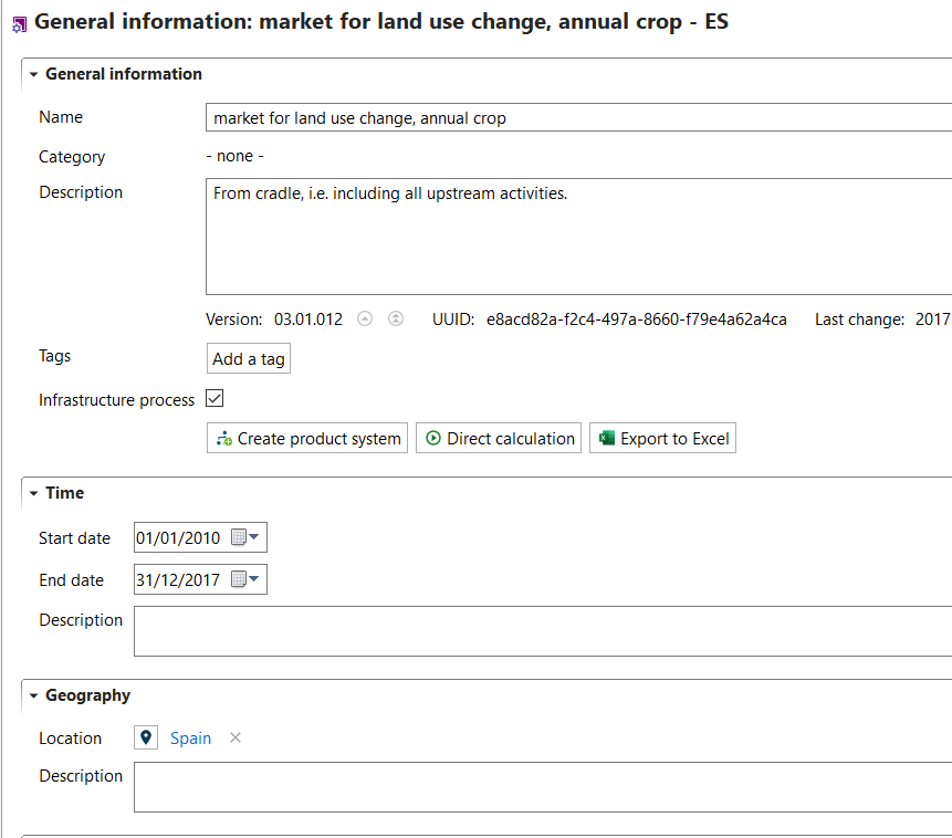
Assigning locations to processes
Location can be assigned to exchanges in processes by adding them to the "location" field for each flow in inputs and outputs.
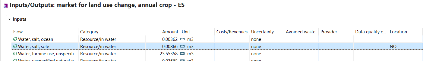
Assining locations to exchanges
Run regionalized LCIA of a product system
To run regionalized LCIA for a product system, select a regionalized impact assessment method and check the box "regionalized calculation". Click on "Finish" to start the calculations.
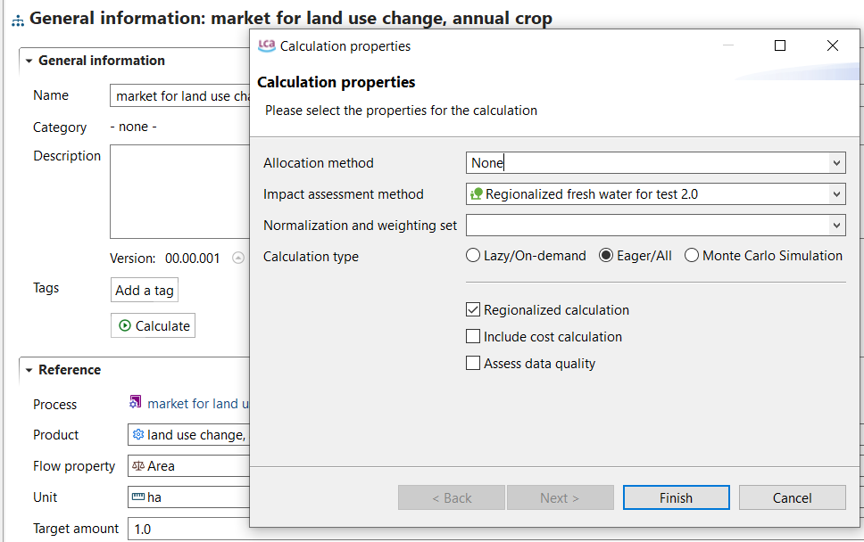
Calcualtion of a regionalized LCIA
Regionalized results can be analysed using different tabs, such as "impact analysis" and "locations".
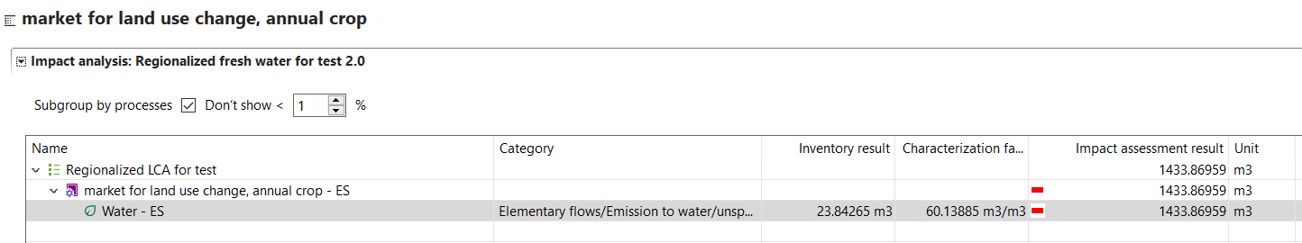
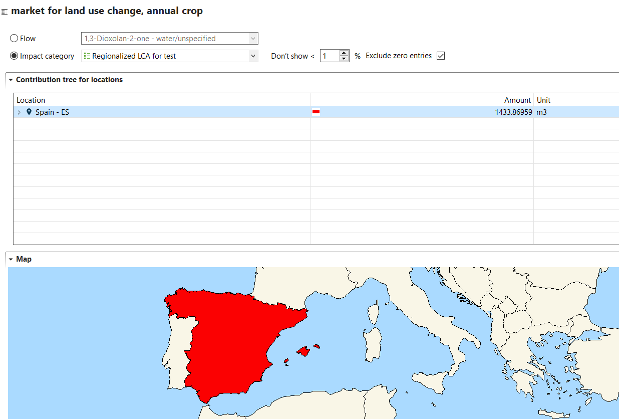
Example results of a regionalized LCIA